Artificial Reefs ·
Texas Completes 320-Acre Reef Using Old Queen Isabella Causeway
Material removed from the derelict bridge between Port Isabel and South Padre Island has been placed at a new Gulf reef site under a Texas General Land Office and Texas Parks and Wildlife partnership.
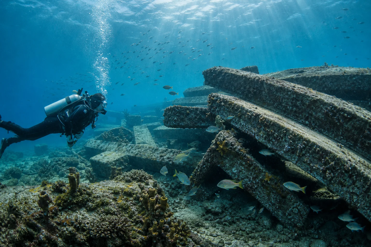
Texas has completed a 320-acre artificial reef using material removed from the Old Queen Isabella Causeway, giving portions of the derelict bridge a new role as offshore habitat near South Padre Island.
The Texas Parks and Wildlife Department says the project was completed in July 2026. The Texas General Land Office managed the causeway’s removal, engineering, design and demolition, while the state’s Artificial Reef Program developed the reefing plan, material-placement protocol and final offshore deployment.
The former causeway connected Port Isabel with South Padre Island before the current Queen Isabella Memorial Causeway opened. Remaining sections had deteriorated into a navigation and public-safety concern, prompting a decommissioning project that began before the reef deployment.
Rather than treating all of the removed structure solely as demolition waste, the partnership redirected suitable material to a newly established reef area. Concrete bridge components add hard surface and vertical complexity to Gulf seafloor that is otherwise often dominated by sand and mud, creating attachment surfaces for sessile organisms and shelter for fish and invertebrates.
The project was supported through the Texas Coastal Management Program with Gulf of Mexico Energy Security Act funding administered by the General Land Office. Texas Parks and Wildlife describes the result as a new reef site—not simply an enhancement of an existing permitted reef.
For divers, the scale is the most notable feature. A 320-acre permitted area could eventually offer multiple targets and broad habitat coverage near one of Texas’s best-known coastal destinations. Bridge material may also provide substantial relief and visually distinctive structures suitable for fish observation, photography and scientific monitoring.
However, the September program update does not publish the reef’s final coordinates, depth, relief, material layout, buoy or mooring status, or current recreational-access guidance. Those omissions matter: the size of the permitted site does not indicate that every part contains reef material, and a completed deployment is not automatically a ready-to-visit dive site.
Before planning a dive, users should wait for the deployment to appear in Texas Parks and Wildlife’s current reef-location data and confirm site-specific information with the Artificial Reef Program or a qualified local operator. Gulf weather, visibility, currents, boat traffic and distance from a suitable inlet can materially affect access.
The former causeway’s history adds a cultural dimension, but the reef is constructed from repurposed bridge material rather than a shipwreck. It belongs in artificial-reef and future dive-site coverage, while any claim about ecological success should wait for monitoring data documenting colonization, fish use and structural stability.
Connected reporting
Dive sites and aquatic life in this story
Reporting record