NBM Dive Site Resource
Barge No. 1
Alpena, Michigan, United States
NOAA-listed Thunder Bay National Marine Sanctuary shipwreck with a seasonal mooring supporting responsible diving or snorkeling access.
Save this dive site to your free member profile.
Historic Picture Placeholder

Aquatic life at this dive site
What divers may encounter
Three reviewed connections are featured here. Sightings vary by season, conditions, and chance, so they are never guaranteed.

Smallmouth Bass
Micropterus dolomieuNOAA places Barge No. 1 on a reef in about 42 feet of Lake Huron water. Sanctuary observations identify smallmouth bass as a dominant fish on warmer nearshore reefs and shipwrecks during summer.
Eric Engbretson, U.S. Fish and Wildlife ServiceOpen Aquatic Life Profile →
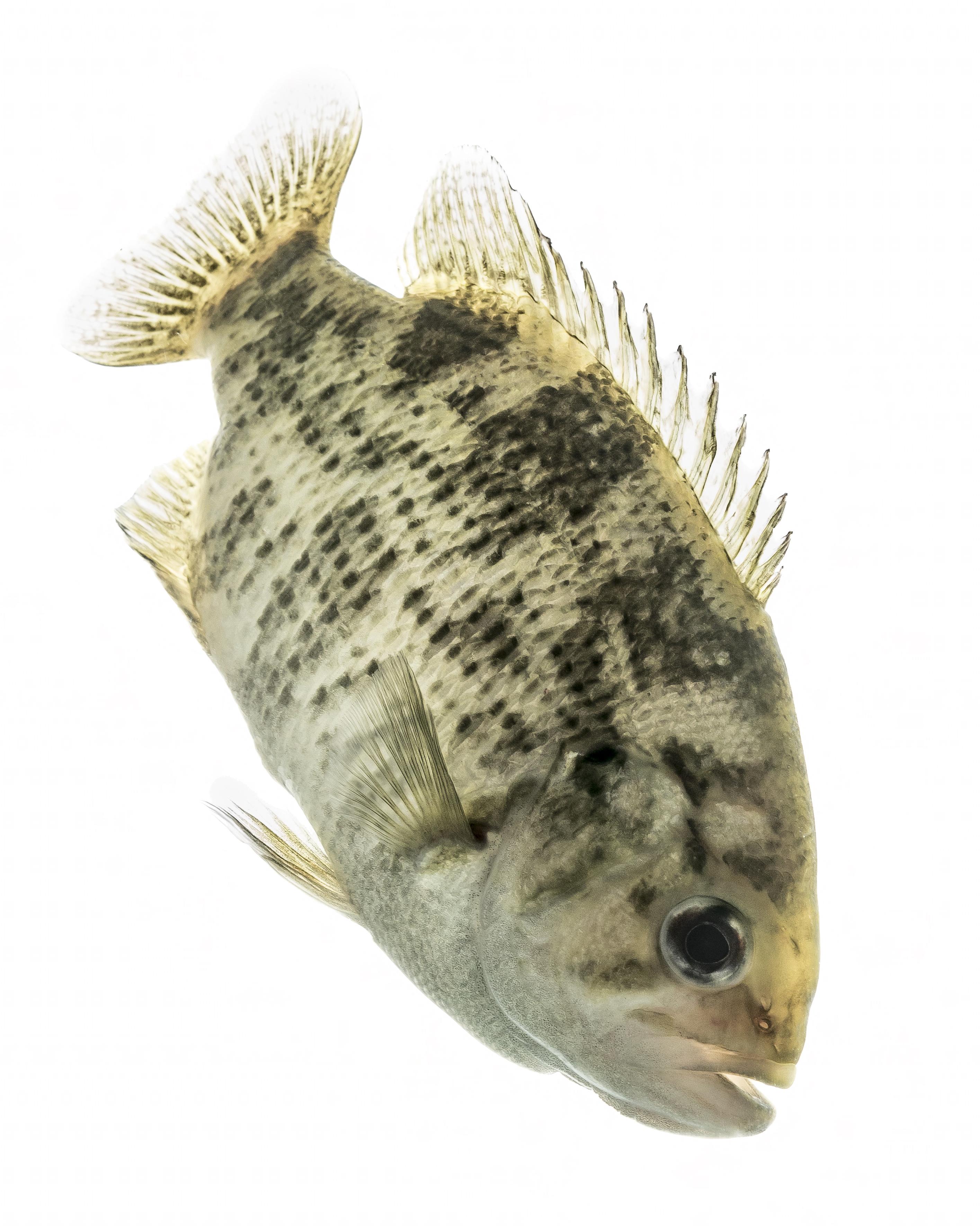
Rock Bass
Ambloplites rupestrisNOAA identifies rock bass with smallmouth bass as dominant on warmer nearshore Lake Huron reefs and wrecks. Search close to the barge's broken structure and reef without entering unstable openings.
Sam Stukel/USFWSOpen Aquatic Life Profile →

Round Goby
Neogobius melanostomusRound gobies are common prey fish on shallow Lake Huron reefs and use rocky structure. Divers may see these small fish resting on the lakebed or lower wreckage around Barge No. 1.
Peter van der SluijsOpen Aquatic Life Profile →
Site media
Photographs
Three views rotate from the published gallery on each visit.
Contributor media
Dive videos
Three featured video positions are reserved on every profile.Published reference location
Location map
The marker shows the public coordinates associated with this profile. Confirm current access, moorings, and departure details before the dive.Map data © OpenStreetMap contributors
Recent field observations
Diver-reported temperatures
Automatically checked observations from dives during the past 14 days. Three reports are visible at a time; scroll for more.A report that passes the automatic checks will appear here with the dive date, diver’s display name, and temperatures at each depth.
Reports are automatically checked for plausible dates, depths, and temperatures. They are observations, not forecasts; confirm conditions before diving.
Seasonal planning reference
Typical monthly conditions
Long-term averages, not a forecast. Actual air and water conditions can change quickly and may vary across the site.Moderate-confidence match — Matched by documented Great Lakes port/area. Air and surface-water values are regional planning averages. No bottom-water line is published because a comparable depth-specific record has not yet been verified.
| Month | Average air | Surface water | Bottom water | Bottom measurement depth |
|---|---|---|---|---|
| Jan | 20.0°F / -6.7°C | 35.5°F / 1.9°C | No reliable record | — |
| Feb | 20.7°F / -6.3°C | 39.5°F / 4.2°C | No reliable record | — |
| Mar | 29.3°F / -1.5°C | 40.5°F / 4.7°C | No reliable record | — |
| Apr | 41.2°F / 5.1°C | 36.4°F / 2.4°C | No reliable record | — |
| May | 53.4°F / 11.9°C | 38.4°F / 3.6°C | No reliable record | — |
| Jun | 63.2°F / 17.3°C | 44.9°F / 7.2°C | No reliable record | — |
| Jul | 68.2°F / 20.1°C | 59.6°F / 15.3°C | No reliable record | — |
| Aug | 66.6°F / 19.2°C | 65.9°F / 18.8°C | No reliable record | — |
| Sep | 59.0°F / 15.0°C | 61.9°F / 16.6°C | No reliable record | — |
| Oct | 47.4°F / 8.6°C | 54.1°F / 12.3°C | No reliable record | — |
| Nov | 36.6°F / 2.6°C | 46.9°F / 8.3°C | No reliable record | — |
| Dec | 26.6°F / -3.0°C | 42.6°F / 5.9°C | No reliable record | — |
NOAA NCEI 1991–2020 U.S. Climate Normals — Alpena, MI
1991–2020 climate normalsReview source ↗NOAA NCEI Coastal Water Temperature Guide — North Huron
Historical monthly station averagesReview source ↗Bottom temperature is never inferred from surface temperature. A blank month means no reliable depth-specific average is available. Data reviewed 2026-08-26.
Why divers know this place
Highlights
Freshwater-preserved Great Lakes maritime heritage site.
Regional context
Located within
Before you arrive
Access notes
Check NOAA’s live buoy status before departure; moorings are seasonal and weather dependent. Published coordinates support regional discovery and are not a substitute for current navigation, active mooring information, operator guidance, permits, weather, or a dive plan.
Plan within your training
Conditions and hazards
Cold water, changing visibility, weather, boat traffic, entanglement, fragile artifacts and possible overhead areas.
Independent resource notice
This record is a starting point for independent verification. Access, closures, moorings, weather, currents, depth, visibility, operator availability, and site conditions can change without notice. Confirm current information with the responsible operator, property owner, managing authority, or another qualified local source before planning or attempting a dive.